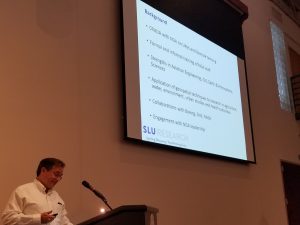
It was a pleasure to represent Saint Louis University at the 2018 US Geospatial Intelligence Foundation (USGIF) Academic Summit, and present on our progress toward a new Geospatial Institute @ SLU
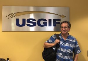
It was a pleasure to represent Saint Louis University at the 2018 US Geospatial Intelligence Foundation (USGIF) Academic Summit, and present on our progress toward a new Geospatial Institute @ SLU

Showing the flag for SLU at a recent Project Connect event, supporting efforts to develop the local geospatial workforce, and showcasing 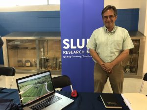 SLU geospatial research and training
At the SLU booth at the GEOINT Symposium Exhibition Hall with Dr. Ken Olliff, SLU Vice President of Research, Bob McNair, Research Strategist, and Mr. Robert Cardillo, Director of the National Geospatial-Intelligence Agency
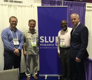
At the USGIF Symposium in Tampa, supporting the Saint Louis University Exhibition Hall booth, and networking with the leaders in geospatial intelligence
The United States Geospatial Intelligence Foundation (USGIF) has established the St. Louis Area Working Group (SLAWG) to bring together key geospatial players in the region to create lasting educational pathways for the community to achieve geospatial degrees, certifications, and careers at National Geospatial-Intelligence Agency (NGA) and other government, academic and commercial stakeholders in the geospatial community. Saint Louis University (SLU) hosted the third SLAWG meeting on October 25, 2017, and Dr. Mark Brickhouse provided an overview of the broad range of geospatial research at SLU, covering disciplines such as remote sensing, environmental sciences, health studies, urban planning, economic development and advanced analytics.
Brickhouse Consultancy, LLC is supporting efforts to grow the scale and eminence of geospatial research and training at Saint Louis University (SLU). We are working to build distinctive strengths in geospatial research, training, and innovation at SLU, and contribute to establishing St. Louis as a national geospatial hub. We are helping SLU to apply their geospatial insights to regional and global challenges, and to develop new partnerships with innovators, industry, federal agencies, and universities. It is a goal of this effort define the path and begin the process of establishing SLU as a national leader in geospatial research, training and innovation.
The first 18 months of the geospatial initiative, from September 2017 through March 2019, were very productive, and we have made enormous progress in growing the geospatial research, training and innovation capabilities at SLU, establishing SLU as the geospatial partner of choice for institutions like the National Geospatial-Intelligence Agency (NGA), and establishing Saint Louis as the National Geospatial Hub. This report includes a month-by-month summary of our support to the SLU geospatial initiatives, and below, please find a summary of our major accomplishments:
NGA CRADA: Completed a new five year CRADA with NGA, expanding the areas of joint research to Unmanned Aerial Systems (UAS), Open Source Indicators and Predictive Tools, and Educational Research. We have as many as 30 SLU faculty who may engage with the CRADA over its lifespan.
Geo-Resolution 2019 Conference and Reception: We have spent the last ten months shaping a new geospatial conference, the first of its kind in the Midwest, to be co-hosted with NGA on April 9. Geo-Resolution 2019 will address the growing Geospatial Ecosystem, the collaboration of industry, government and academia, that can make Saint Louis the National Geospatial Hub. We have over 120 local and national geospatial, civic and business leaders attending our April 8 welcome reception, and 650 are registered to attend the conference on April 9, an exceptional turn-out for an inaugural event.
Geospatial 101: The GeoSLU team completed the first series of evening symposia, Geospatial 101, on basic and emerging concepts in the geospatial sciences. The meetings served to improve community knowledge of the local geospatial enterprise, outline geospatial career opportunities, showcase SLU research and training capabilities, and provide a lead-in for the April 9 Geospatial Conference. We had over 200 attendees, and a second series for the Spring 2020 semester
GeoSLU: GeoSLU was one of the first three Big Idea proposal to win a seed grant, and I have worked faculty leads Vasit Sagan, Ness Sandoval and Enbal Shacham to develop the plan to consolidate and grow the geospatial training, research and innovation enterprise at SLU. We have over 20 faculty who have participated in brainstorming and geospatial retreats, and we have led a number of community engagement efforts to make SLU the geospatial research and training partner of choice in Saint Louis.
Geospatial Institute and Business Plan: The GeoSLU has completed a business plan to establish a University-wide Geospatial Institute at SLU, which outline how SLU can grow geospatial research and training over the next five years. The team has already been successful in growing the geospatial research base, having secured over $1M of external grant funding in the last six months, and having submitted nearly $5 million-dollar grant proposals pending award.
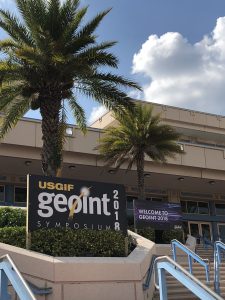
GEOINT 2018 and 2019: SLU was the only Saint Louis organization to have a booth at the GEOINT 2018 Symposium in Tampa, FL last year, a point not lost on Andy Taylor, who now sees geospatial investment as a way to change the narrative about Saint Louis. We participated in a number of panels and plenary presentations, and will return to GEOINT 2019 this year. Our success was also noticed by the Saint Louis Development Corporation (SLDC), which is also sponsoring a booth at GEOINT 2019, and we are working with them on a comprehensive Saint Louis marketing effort, informed by the recently unveiled SLTMade economic development initiative.
USGIF GEOINT Certificate: The GeoSLU team is working on the Self-Study for the accredited geospatial intelligence (GEOINT) certificate, which is being updated based on the new Essential Body of Knowledge (EBK). We are cross-walking required GEOINT proficiencies with the topics covered in our current GIS and intelligence courses, and plan to submit the Self-Study in August.
USGIF Academic Summits: We have participated in the last two USGIF Academic Summits, and we are the only Jesuit university currently pursuing the USGIF-accredited GEOINT certificate. SLU strengths in human geography, urban studies, public health, water, food and environment, all informed by the Jesuit mission, give us a unique and distinctive voice in the growing geospatial community.
NGA Training Opportunities: We are coordinating with NGA to provide training to their analysts as part of their modernization program. Part of the NGA cultural change is to make all mappers and analysts data scientists so they can more independently update and build tools to assist in missions like change detection, to make them less dependent on proprietary software. The School for Professional Studies (SPS) has enrolled its first NGA analysts pursuing training in areas like Python coding.
New Corporate Partnerships: The GeoSLU Advisory Board includes members from Arch2Park, Ameren, Boundless, ESRI, Harris Geospatial Solutions, LaunchCode, OGSystems, T-Rex, Worldwide Technology and Vertical Geo; they provide periodic review on how to continue to grow the Geospatial Institute. We have Cooperative Research and Development Agreements (CRADAs) in place or pending with Ameren, Booz Allen Hamilton, Harris Corporation, Leidos and Boundless
USGIF and SLAWG Participation: The Saint Louis Area Working Group (SLAWG) is the only geographically-defined working group o fate USGIF, a testament to the critical mass of geospatial expertise in the area. SLU has been a participant since the SLWG began in 2017, and we are regular speakers, meeting hosts and participants in several sub-committees. I have also been an invited panelist at the USGIF Tech West Showcase, and SLU hosted a K-12 engagement event after the 2018 Tech West Showcase. The SLAWG has over 200 members, representing almost all of the local Geospatial Ecosystem.